mapry
forestry
Simplify forestry and forest management research work. The perfect tool for forest maintenance, from acquiring highly accurate data to creating wild birds.。
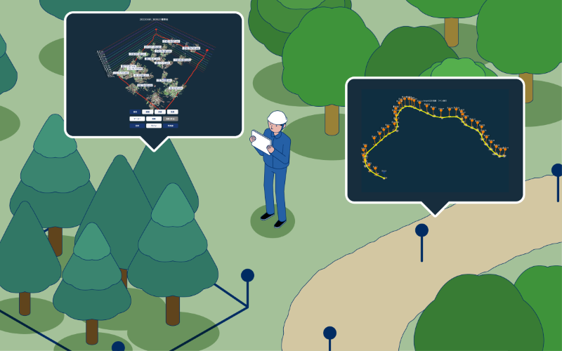
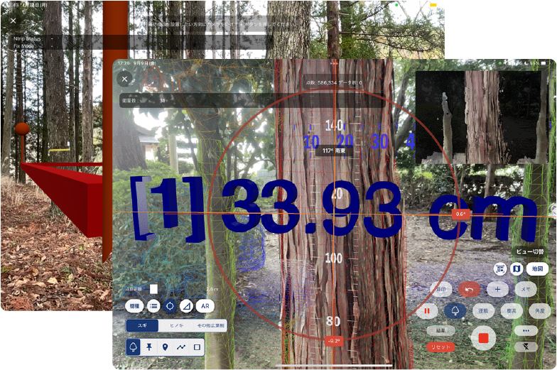
Every tree survey
The diameter, position, and height of each standing tree can be measured. Standard land surveys and plot installation are also available.
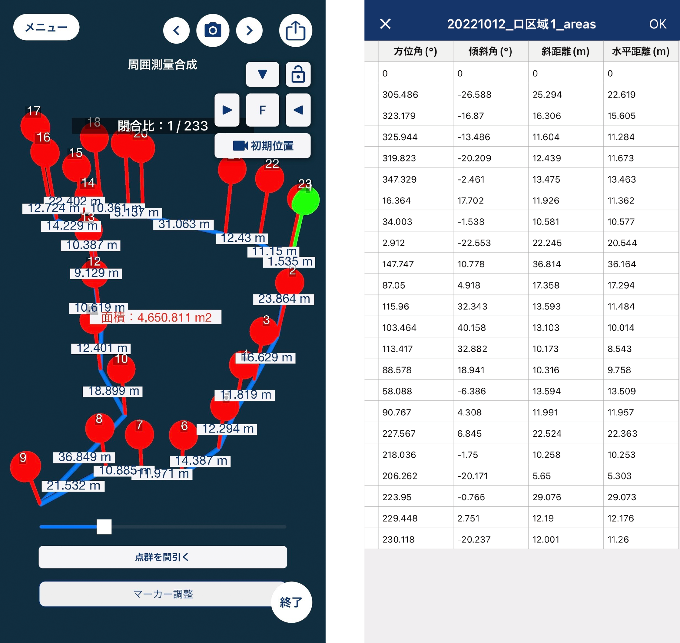
Surrounding survey
Set up markers and survey the surrounding area. You can calculate azimuth, inclination, oblique distance, and horizontal distance using just your iPhone. You can easily create survey field notes from measured data.
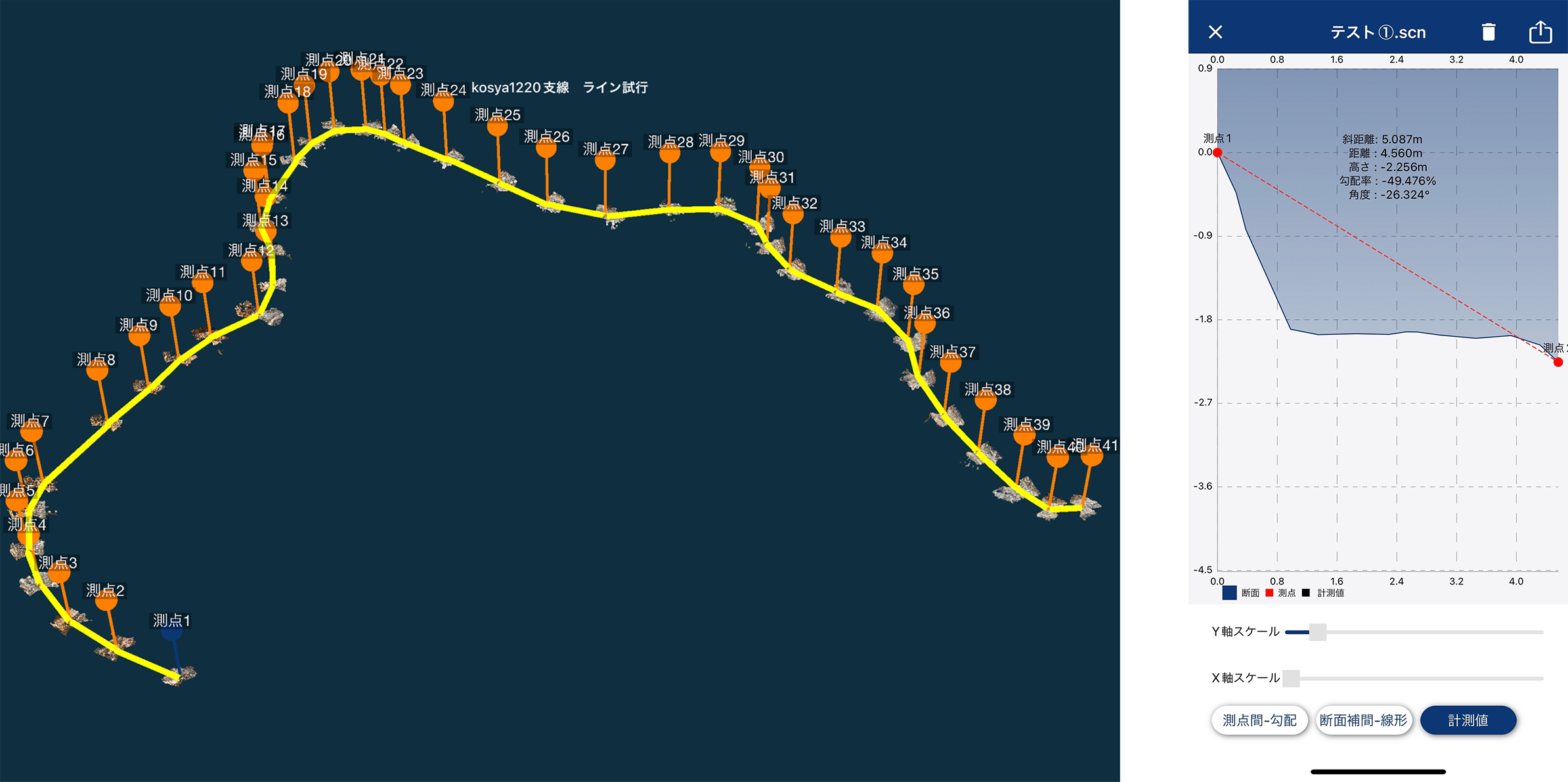
Work path measurement
It is possible to calculate the total length, measure longitudinal and cross-sectional views, width, ground slope, etc. Field notes can be created from the measured work path data.
Price
価格
Monthly (excluding tax)/
yen


Related services
Application
mapry forestry

Simplify forestry and forest management research work. The perfect tool for forest maintenance, from acquiring highly accurate data to creating wild birds.
mapry wood acceptance inspection

A volume measurement app using an iPhone. You can measure the diameter grade and calculate the volume using the video. Free to use, collaboration with mapry platform and 3D wood market.
Hardware
LA03(LiDAR)

Simplify daily forest management and all research tasks. Provides functions specialized for forest management.
R1(GNSS)
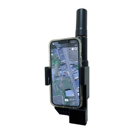
GNSS provides high-precision location information. When combined with an iPhone/iPad, it achieves performance equivalent to conventional surveying equipment.
M1(Drone)
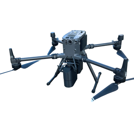
A LiDAR measurement drone that works with mapry drone version and can be used at low cost. You can share images and videos taken during operation and automatic flight.
Platform
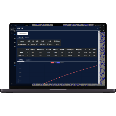
mapry platform
A platform that enables real-time sharing and management of forest information. Support from forest surveys to calculation of carbon dioxide absorption amount.
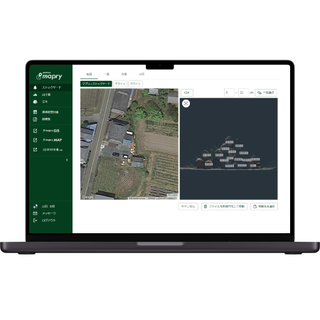
mapry GIS
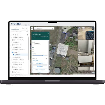
Easily acquire and manage high-precision data. You can easily share map creation data using a web browser. It is possible to connect with mapry forestry.
mapry forest map
A web service that allows you to easily utilize forest information.
mapry 3D wood market
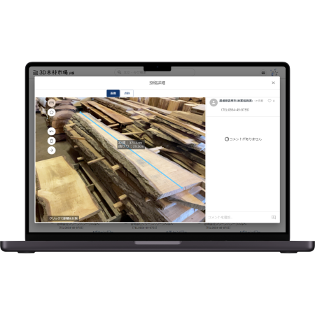
Online timber trading service. It is also possible to trade wood that is not distributed through direct sales.