Surveying/Construction ICT
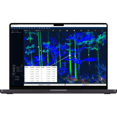
ICT construction, drawing CAD linkage, soil volume measurement and analysis are possible from high-precision point cloud data.
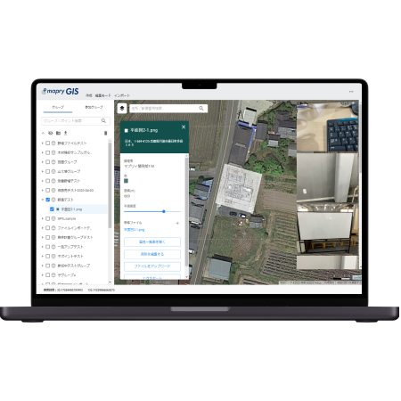
Surveying/Construction Solving various ICT issues!
- I would like to use construction surveying and completed forms.
- I want to understand the front and back shape and volume of excavation and embankment from point cloud data.
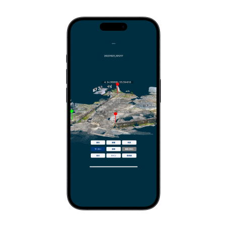
- I want to search for coordinates using the stakeout function
- I want to obtain high-precision coordinates for drawings on site.
- I want to locate the construction area and excavation area using AR.
- I want to calculate the surface area
- I want to measure the volume and manage the progress of soil pits, material stockyards, etc.
- I want to output as DXF data and link with CAD
Services that can be used for forest management
Application
Hardware
LA01(LiDAR)
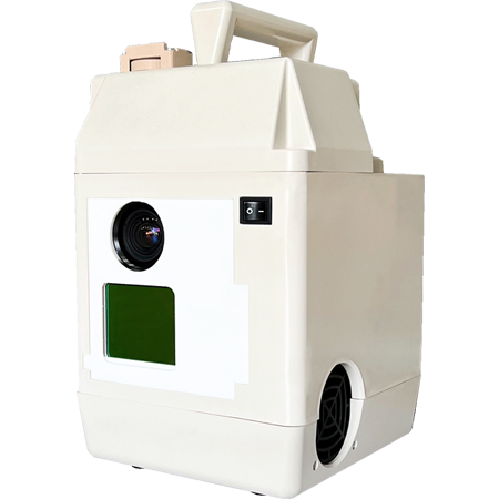
Ideal for understanding current conditions and acquiring data at construction sites. Hand-held or in-vehicle measurements are also possible.
R1(GNSS)
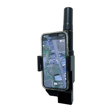
GNSS provides high-precision location information. When combined with an iPhone/iPad, it achieves performance equivalent to conventional surveying equipment.
M1(Drone)
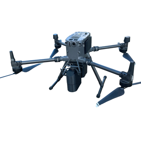
A LiDAR measurement drone that works with mapry drone version and can be used at low cost. You can share images and videos taken during operation and automatic flight.
Platform
Point cloud analysis
Flow of implementation
Our representative will conduct an interview and propose the optimal plan for your issues.
Form
Our representative will conduct an interview and propose the optimal plan for your issues.
Hearing/Plan proposal
We will hear from our sales representative. We anticipate visiting the site or meeting online. We will propose the best plan for your needs.
Introduction
Usage will begin upon signing the contract and installing the equipment. Our dedicated staff will provide continuous support from installation to operation.