Can be used for surveying a wide range of sites
Construction sites, land and house surveys,
construction consultancy and surveys, forest engineering,
roads, bridges, cultural heritage, BIM/CIM, etc.
-
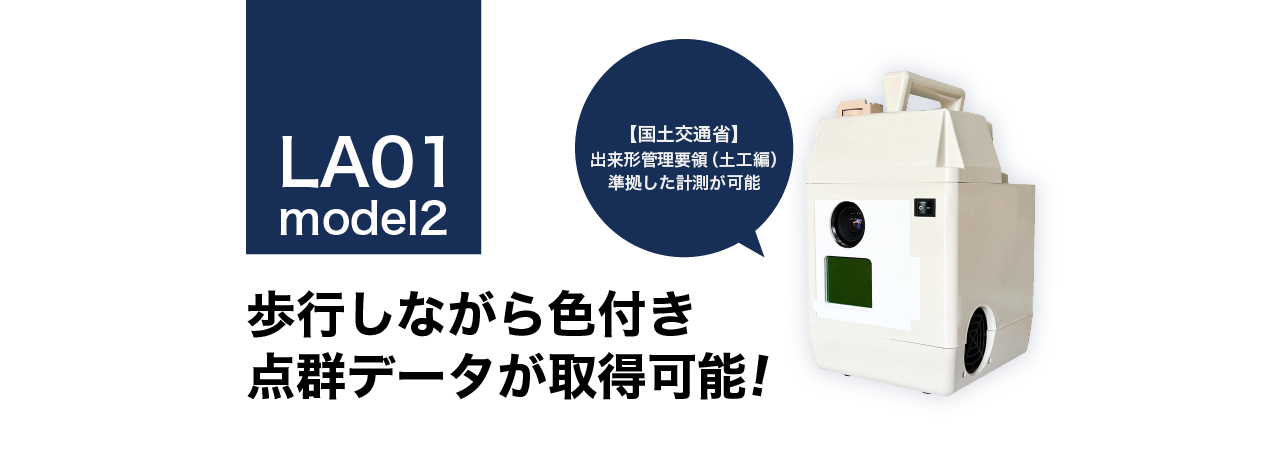
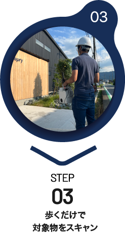
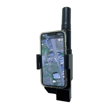
Feature 1:Moving/fixed coloured point cloud data acquisition
Coloured point clouds can be acquired while moving on foot, allowing smooth measurements even over large areas.
-
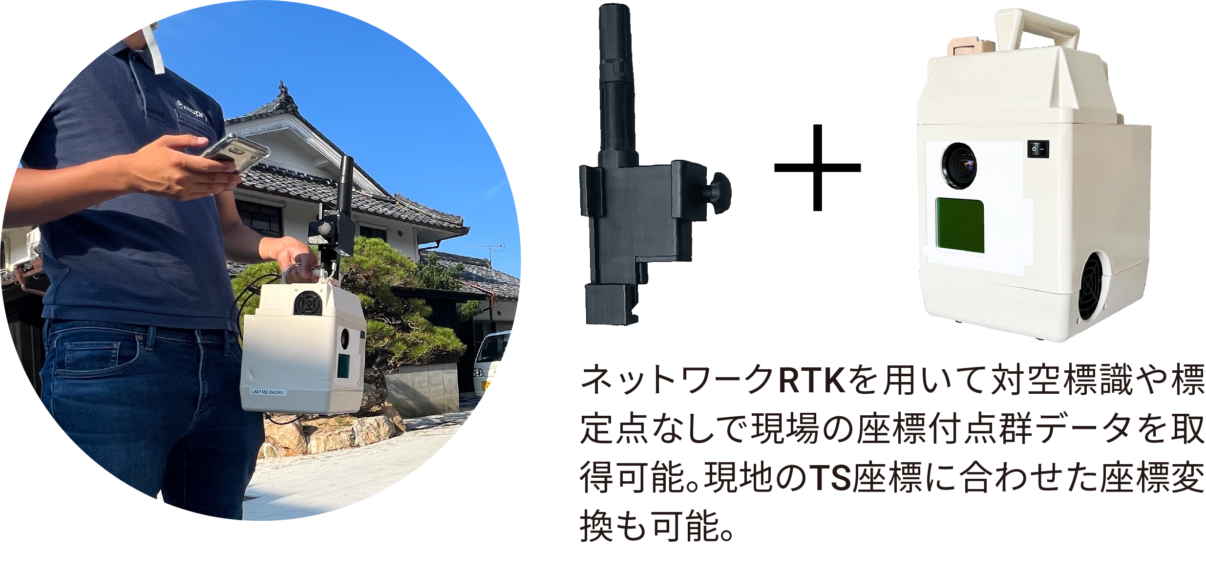
Feature 2:Public coordinates can be assigned.
-
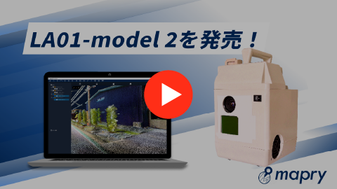
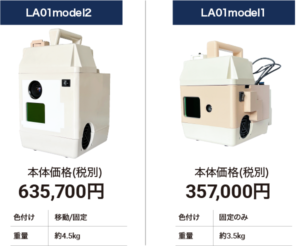
Feature 3:Unparalleled ‘low cost’
Price (excluding tax)
675,700yen
Price of the unit including battery, case and USB
- ※The following equipment is also required for operation. Separate maintenance options available.
- ・operation terminal 62,500yen ・R1(GNSS receiver) 95,000yen
- ・application fee 10,000yen/month
- ・Ntrip service fee (please sign up separately)
-
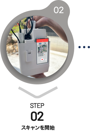
Feaature 4:Easy high-precision surveying without specialist knowledge
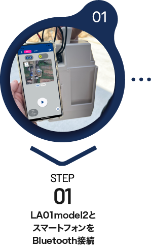
Bluetooth connection to the phone, start scanning, then just walk away.
-
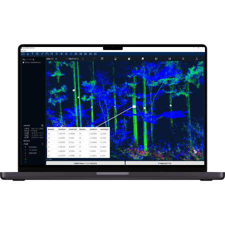
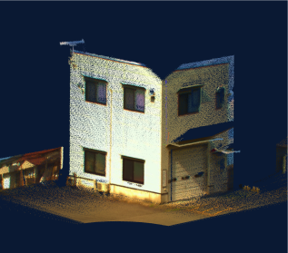
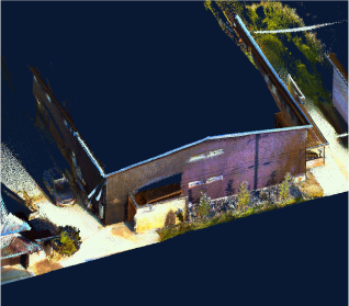
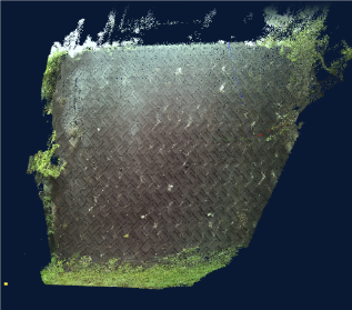
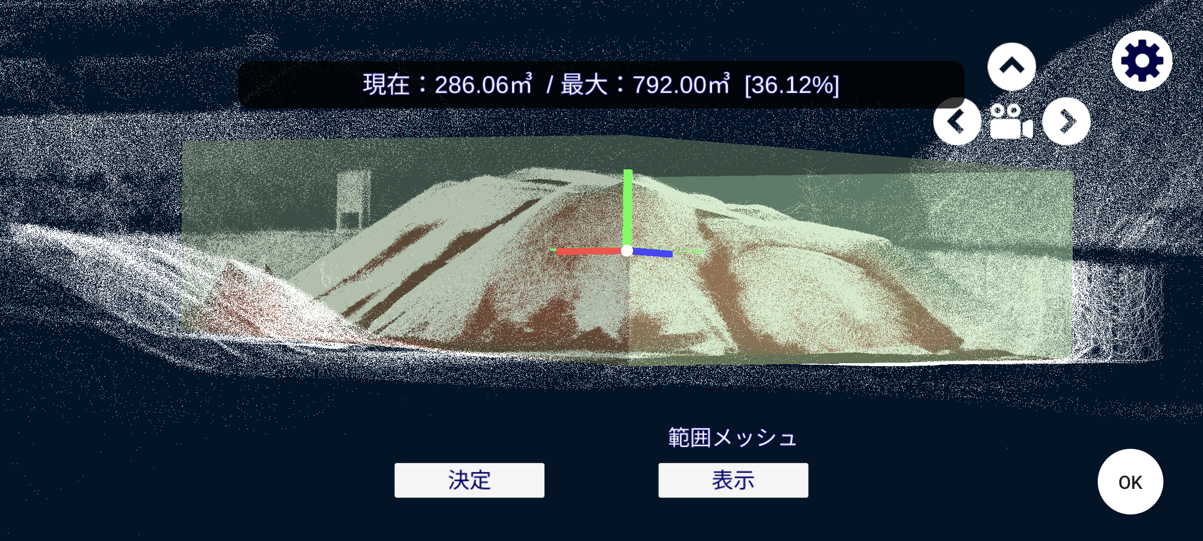
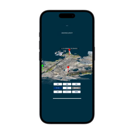
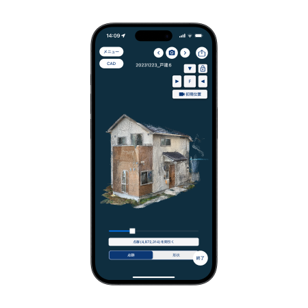
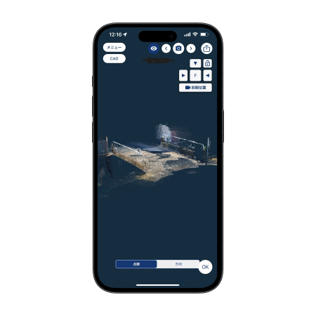
Examples of 3D point cloud data.
-
Other features.
Analysis software available for an application fee.
- ①
LAS output of point cloud data
- ②
Checking videos acquired simultaneously with point clouds.
- ③
Creation of topographical models, DXF data conversion of cross sections, etc.
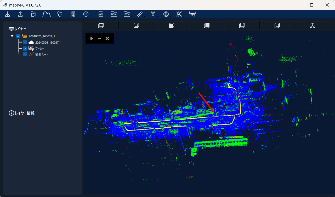
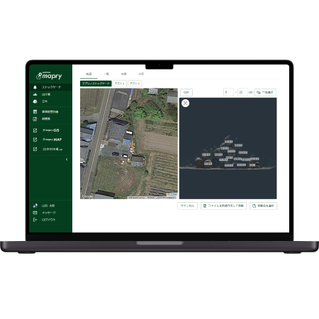
Point cloud analysis software(mapry PC)
-
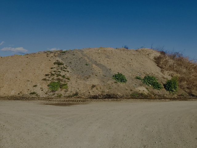
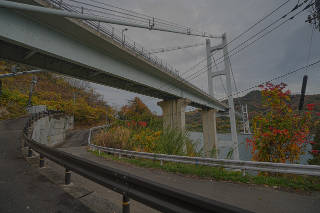
LA01 introduction site
Current survey, groundbreaking survey, etc.
Structures (bridges, poles, buildings)
Dimensional surveying of slopes, etc.

-

-
LA01 spec
common specs
Coordinate Assign public coordinates in RTK. Maximum distance to be covered 200m FOV Horizontal angle 70° Vertical angle 75 Measuring method Fixed/mobile Coordinate transformation Euclidean transformation possible at three fixed points. -
Management function
Management of materials and soil quantities.
関連するサービス
アプリケーション
mapry 測量
LiDARを用いた三次元測量アプリケーション。国土交通省「三次元計測技術の出来形管理要領」に準拠した計測が可能。
mapry 塗装
林業や森林管理の調査業務を簡単に。精度の高いデータ取得から野帳作成まで、森林整備に最適なツール。
mapry 橋梁
ドローンを用いて点検を行い、計測した点群データから野帳を作成。
ハードウェア
プラットフォーム
mapry platform(β版)
森林情報をのリアルタイム共有と管理を可能にするプラットフォーム。森林調査から二酸化炭素吸収量の算出までサポート。
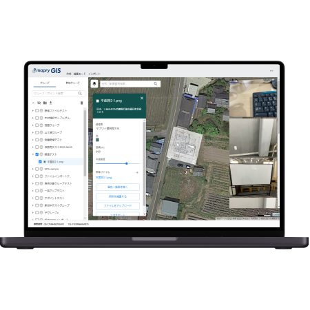
mapry GIS
高精度データの取得と管理を手軽に。地図作成データ共有までWebブラウザで簡単に行える。mapry測量と連携が可能。